Free OnlineAI City Layout Generator
How to Visualize a City Layout with AI
Define the Site and Nonnegotiables
Write the Urban Design Brief
Generate a Concept Masterplan Visual
Compare Options and Mark Questions
Why Choose Mew Design for AI City Layout Generation
Start with a Site Sketch or Aerial
Upload a boundary sketch, base plan, or aerial reference and identify fixed roads, waterways, heritage assets, steep slopes, and access points that should organize the concept.
Show Land Use and Movement Together
Connect housing, jobs, schools, retail, services, transit, walking, cycling, freight, and open space so the layout communicates more than colored zoning patches.
Explore Walkability as a Spatial Idea
Visualize smaller blocks, connected pedestrian routes, neighborhood centers, daily services, shaded paths, and reduced car dominance for an early 15-minute-neighborhood concept.
Compare Density and Massing Patterns
Ask for higher intensity near stations, stepped heights near existing neighborhoods, courtyard blocks, perimeter blocks, towers on podiums, or lower-rise clustered housing.
Communicate Green and Blue Infrastructure
Show parks, tree corridors, wetlands, bioswales, floodable landscapes, urban cooling routes, habitat links, and waterfront access as a connected system.
Create Multiple Presentation Modes
Turn one brief into a land-use diagram, polished aerial masterplan, isometric massing view, or annotated comparison board for different audiences.
How to Write an Effective AI City Layout Prompt
- Anchor the Base: State boundary, dimensions or area, orientation, terrain, water, existing fabric, connections, and protected features.
- Quantify the Brief Carefully: Add broad program, density, height, catchment, block, open-space, or mode-share goals only as concept inputs—not verified outcomes.
- Describe Networks: Explain street hierarchy, transit spine, walking and cycling links, freight, emergency access, utilities, parks, drainage, and habitat continuity.
- Choose the Review Graphic: Request a land-use diagram, aerial masterplan, massing study, street section, or option-comparison board with a clear legend.
AI City Layout Prompt Examples You Can Adapt
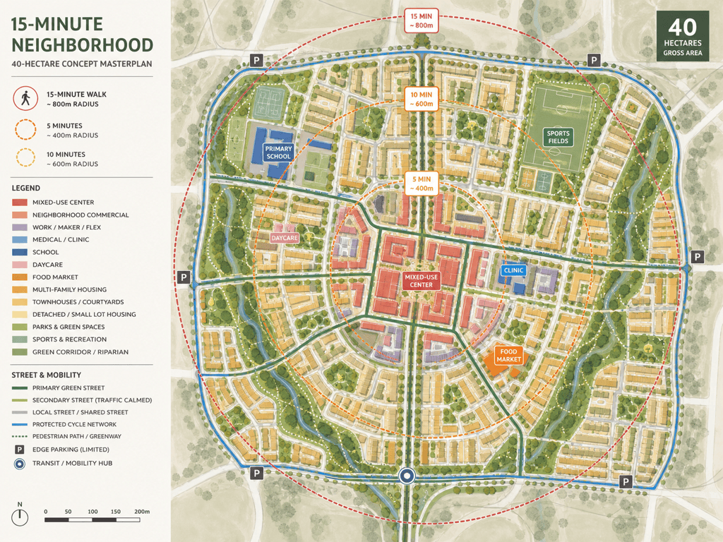
15-Minute Neighborhood: Create a conceptual 40-hectare walkable district with mixed-use neighborhood center, primary school, clinic, food market, sports fields, daycare, and varied housing within connected walking and cycling routes. Use small blocks, traffic-calmed streets, shaded green corridors, limited surface parking, and a clear land-use legend.
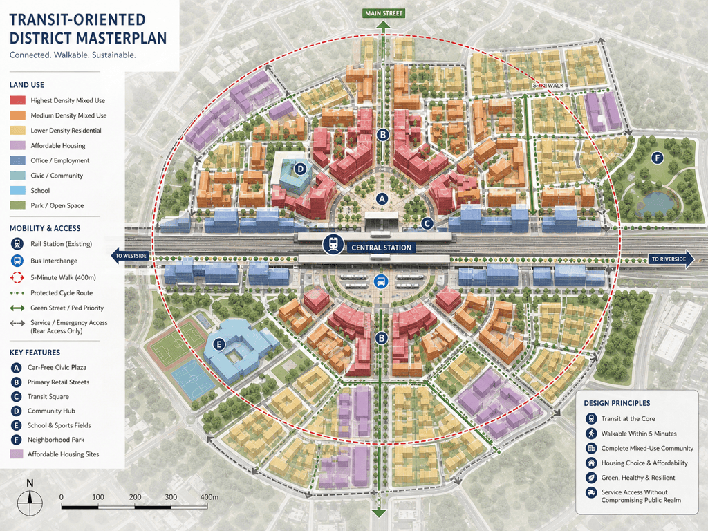
Transit-Oriented District: Visualize a station-area masterplan with the highest mixed-use density within a five-minute walk, bus interchange, protected cycle routes, car-free civic plaza, affordable housing sites, offices along the rail edge, school and park in quieter areas, and service access that avoids the main pedestrian streets.
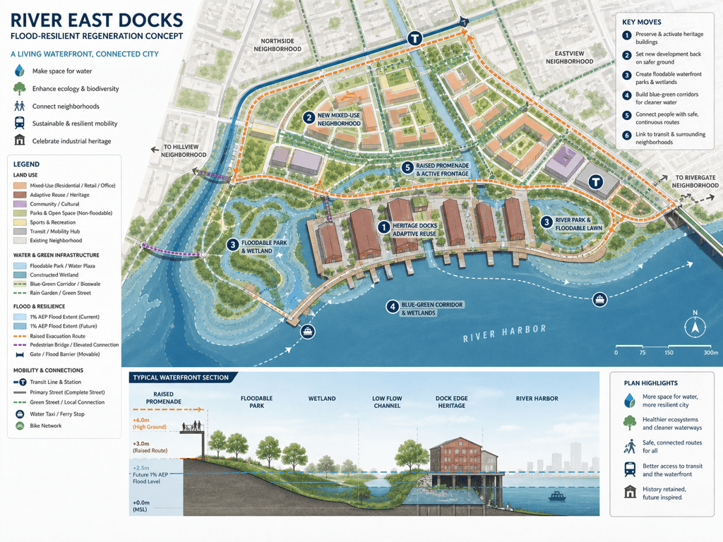
Flood-Resilient Waterfront: Create an urban layout concept for a former dockland beside a flood-prone river. Keep industrial heritage structures, set buildings back from the water, add floodable parks, wetlands, raised evacuation routes, mixed-use blocks on safer ground, continuous waterfront access, and blue-green drainage corridors.
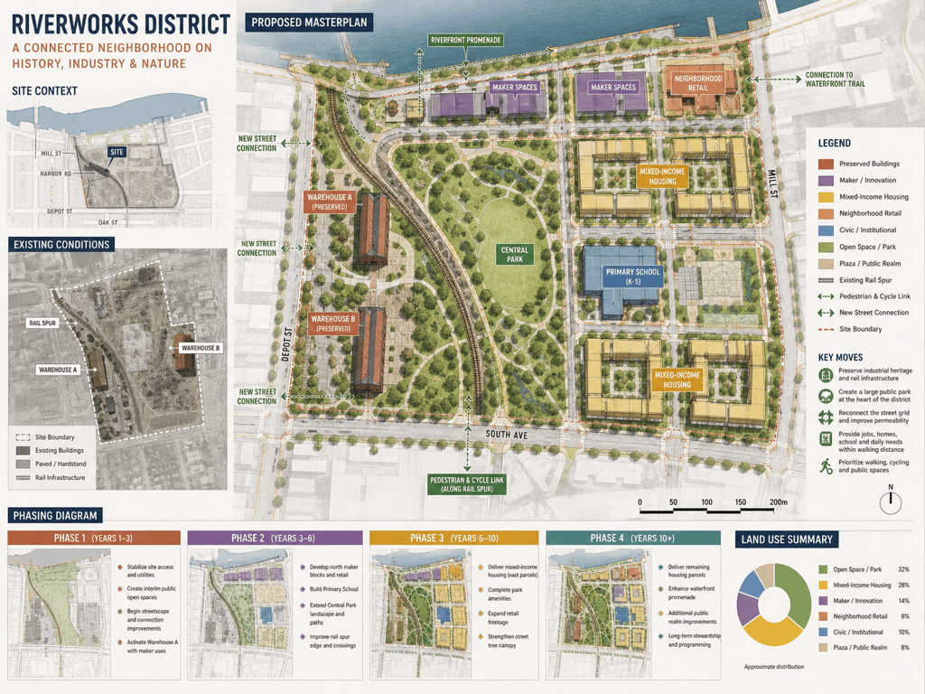
Brownfield Regeneration: Turn my uploaded industrial site sketch into a mixed-use masterplan concept. Preserve two landmark warehouses and the rail spur, remediate the central yard as a park, connect surrounding streets, introduce maker spaces, housing, school, local retail, and phased development parcels. Show existing versus proposed elements.
Heat-Resilient Desert District: Design a compact urban layout organized around shaded courtyards, narrow east-west pedestrian streets, transit boulevard, solar canopies, water-efficient parks, district cooling, mixed-use centers, and short routes to schools and clinics. Use an isometric planning board with shade and wind arrows.
Option Comparison: Create a three-panel urban design board for the same 25-hectare site. Option A prioritizes a connected street grid; Option B creates a central linear park; Option C clusters development around two transit stops. Keep the site boundary and program constant, and show land use, streets, green space, and key trade-offs consistently.